Armadillo & Dicker / Books on Main
![Six [6] RADIAL ZONE MAPS - CALIFORNIA HIGHWAY ROADSIDE BEAUTIFICATION SURVEY, 1932](https://bookandpaperfairsonline.us-east-1.linodeobjects.com/thumbs/1721886824ZoneA2.jpeg)

[CARTOGRAPHY / MAPS]
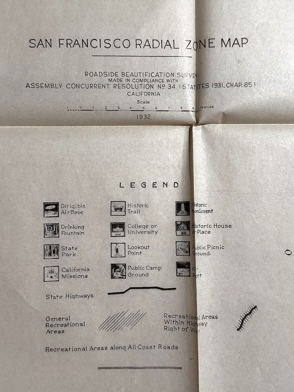
Six [6] RADIAL ZONE MAPS - CALIFORNIA HIGHWAY ROADSIDE BEAUTIFICATION SURVEY, 1932
$250
Item Details
California Dept of Public Works, Division of Highways, 1932
1st eds., Fine
Six [6] RADIAL ZONE MAPS - CALIFORNIA HIGHWAY ROADSIDE BEAUTIFICATION SURVEY, 1932.
California Dept of Public Works, Division of Highways 1932.
27x24” – folded to 9x12"
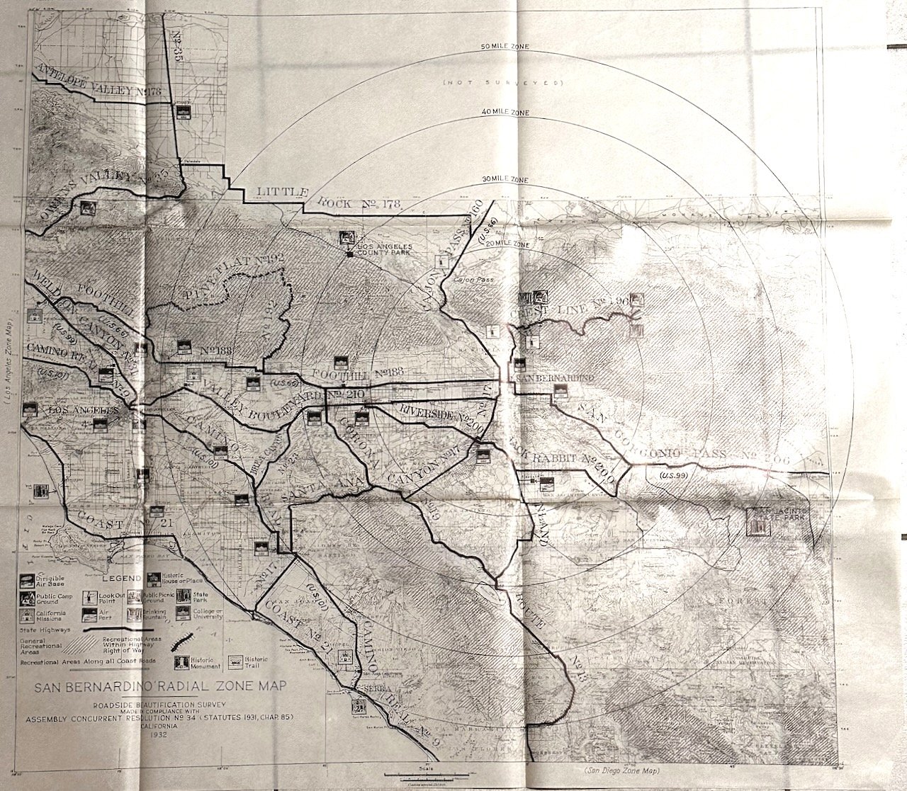
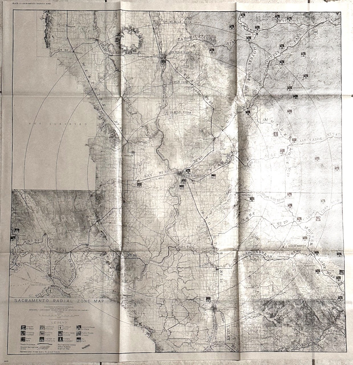
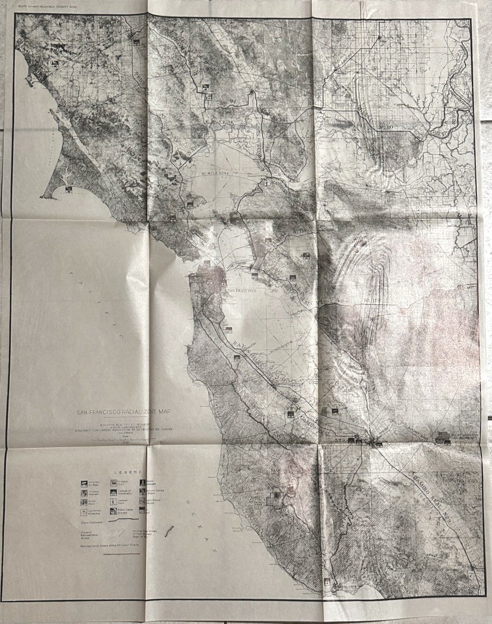
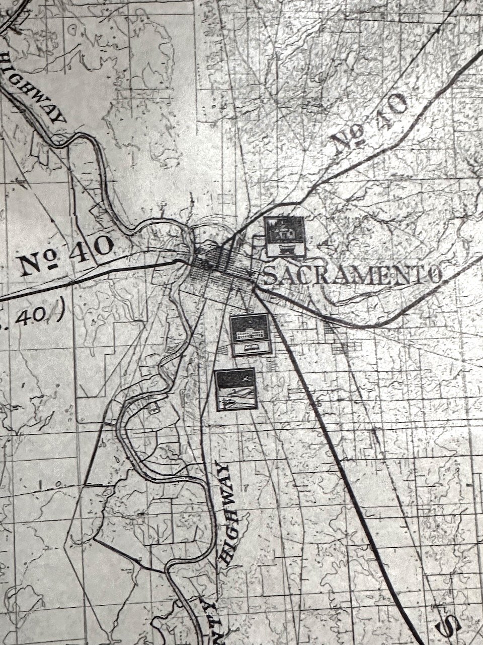
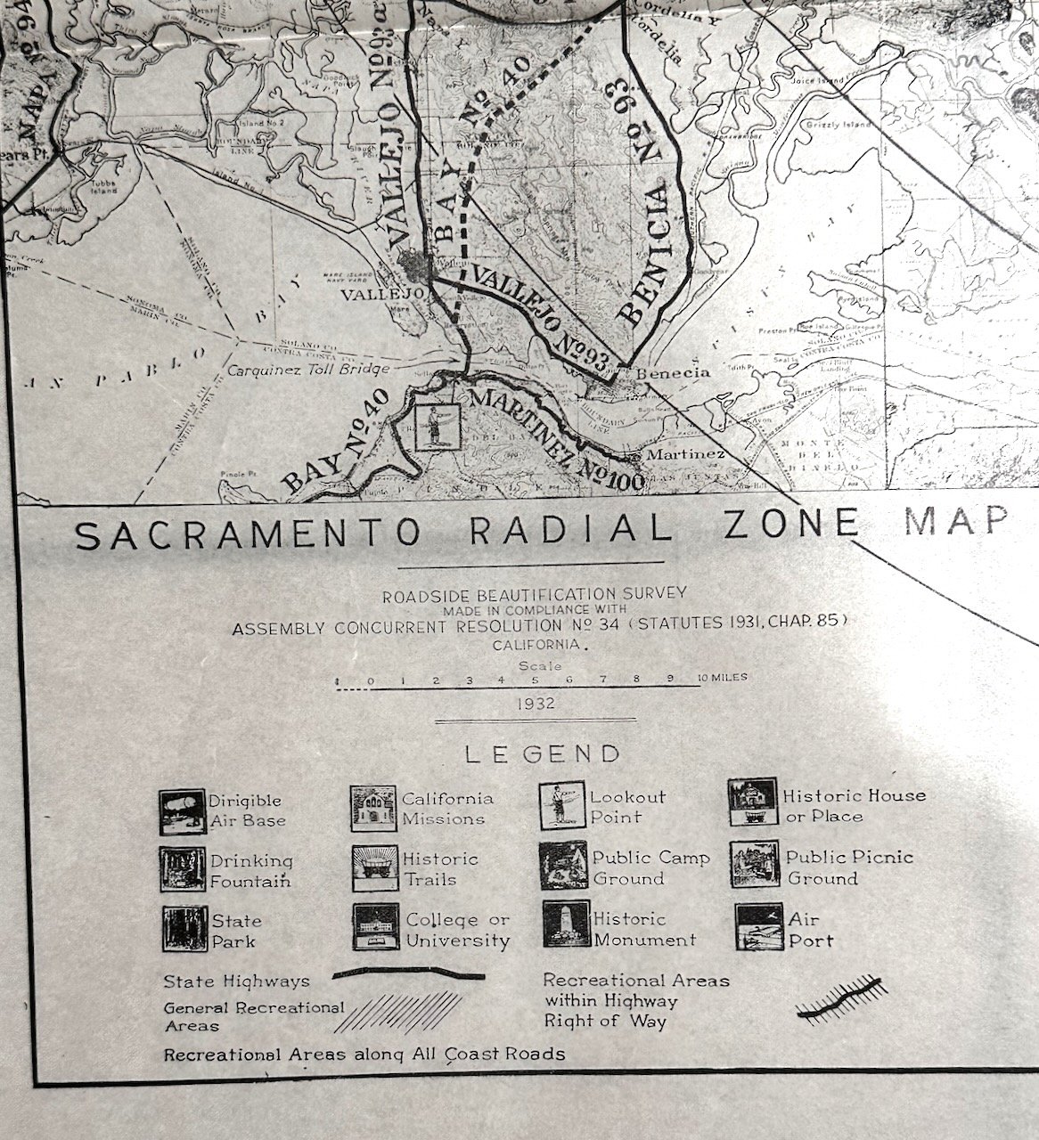
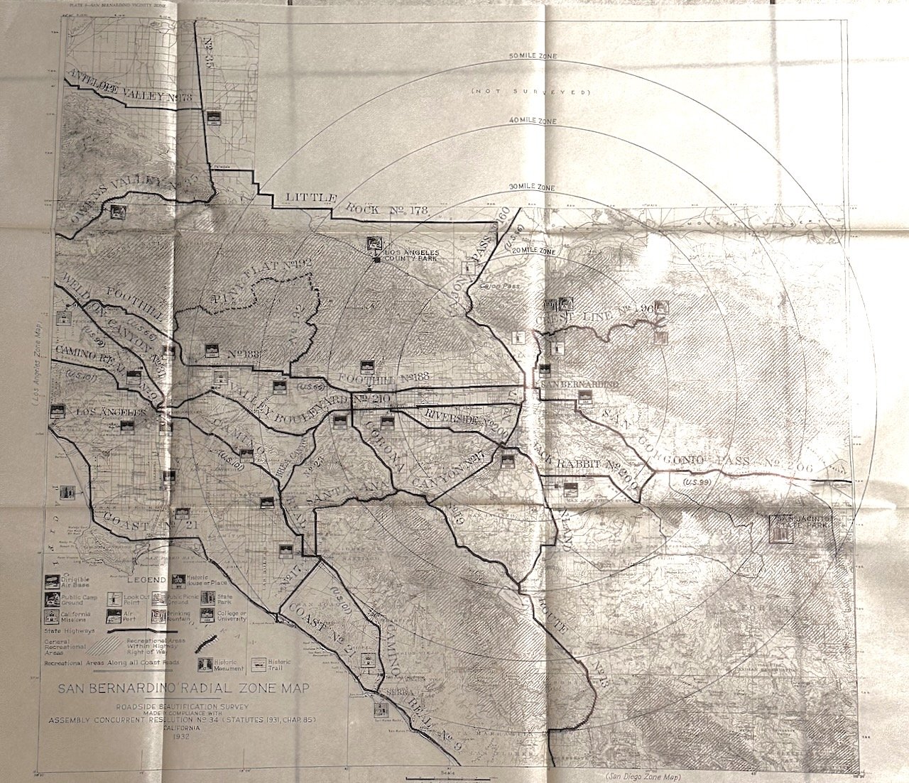
These six maps comprise a roadside beautification survey showing the distance of historic trails, monuments, and buildings to major highways within each radial zone area. Depicting Central and Southern California highways, missions, historic buildings and monuments, recreational trails and campgrounds, and even dirigible bases! Reliefs are shown by contours and spot heights; with radial distances from the center of the zone.
- San Diego Zone – Plate 8 – The map boundaries are Mission Viejo to the north and Otay Mesa to the south.
- San Bernadino Zone - Plate 9 –Parts of Los Angeles to the west and Cleveland National Forest to the Southeas; also includes the Owens Valley to the north. Los Angeles also has its own roadside beautification survey.
- Los Angeles Vicinity- Plate 10 - Ventura on the north to South Coast [Orange County]
- Santa Barbara Zone -Plate 11 –Guadalupe to the northwest and Santa Monica to the southeast.
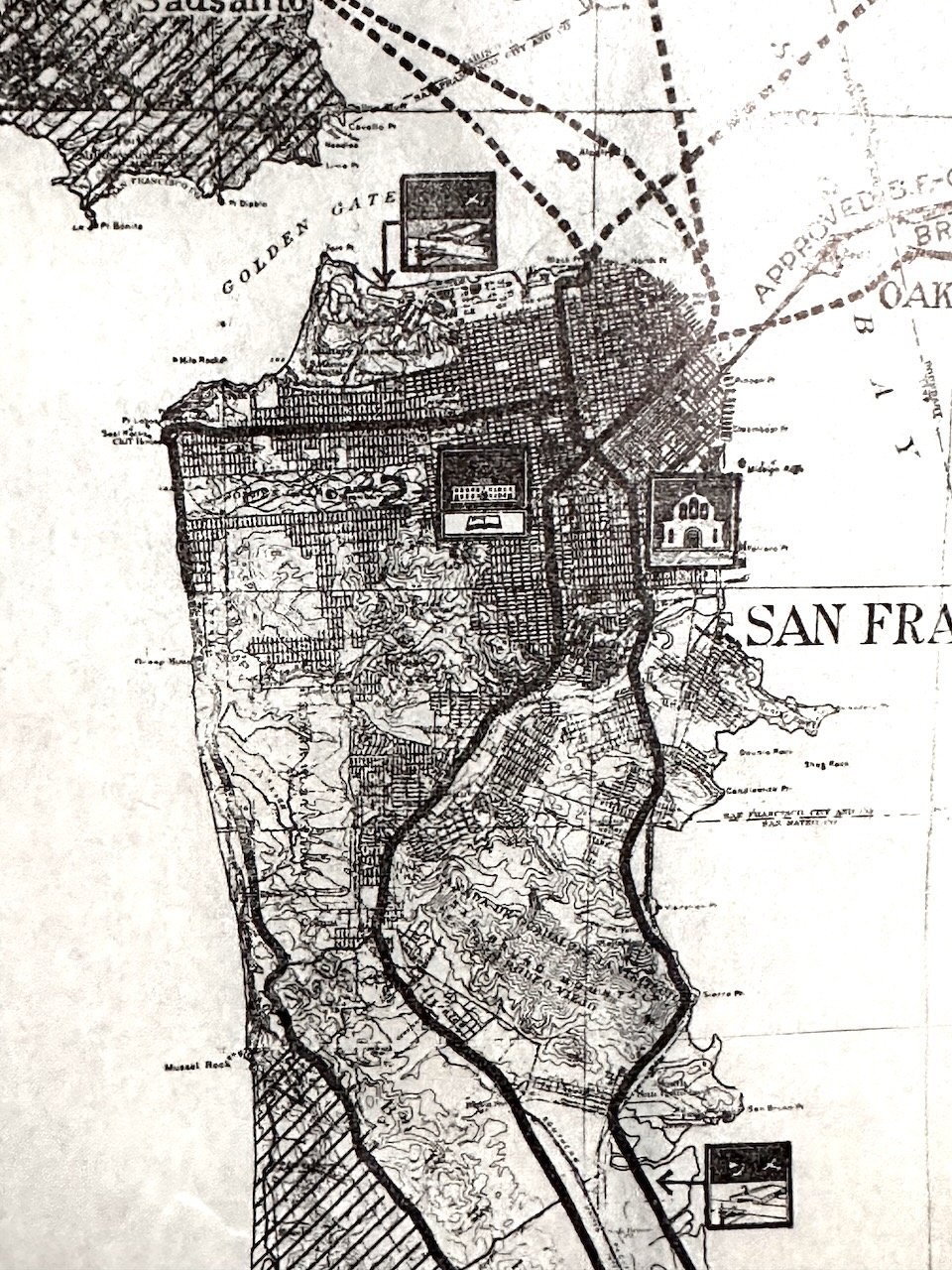
- San Francisco Zone – Plate 12 - Point Reyes to Pacifica
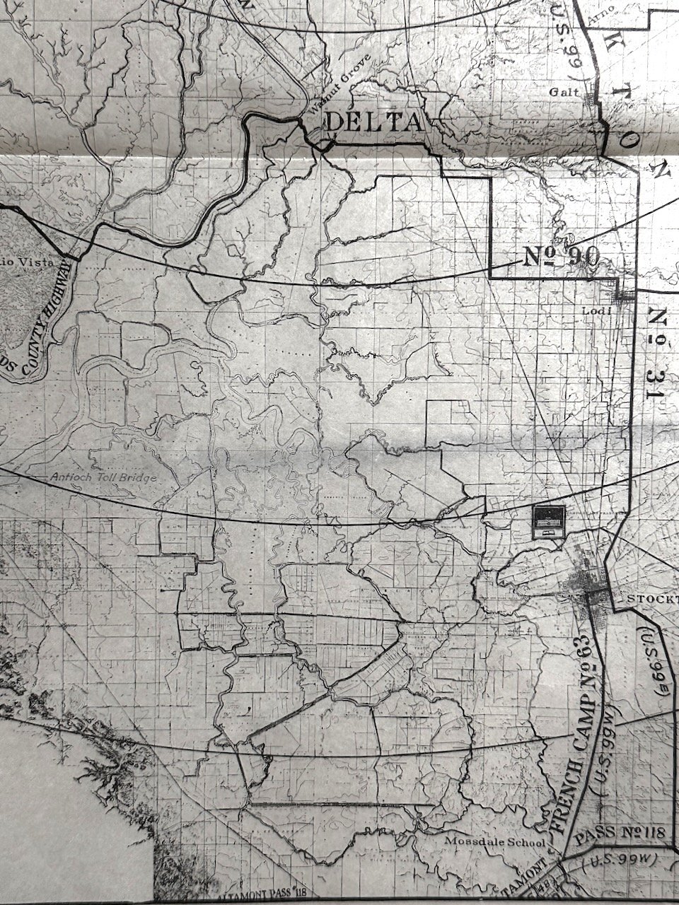
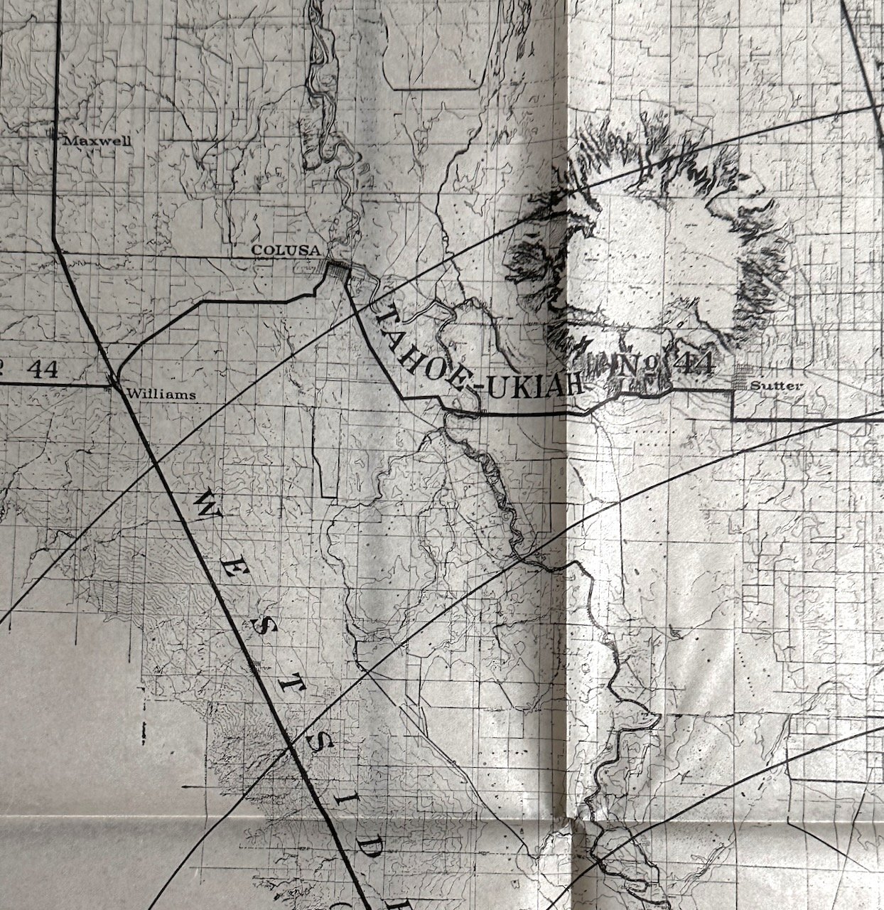
- Sacramento Zone – Plate 13 - Colusa to the north and Manteca to the south. A portion of this survey includes Sonoma and Napa counties, also found in the San Francisco Area Zone, and Lake Tahoe to the east.
Though labeled plates 8-13, these six maps are all that were published. Plates 1-8 were images in an accompanying 53-page publication not present here: California Highway Roadside Beautification Survey : Progress Report. California Division of Highways, 1932.
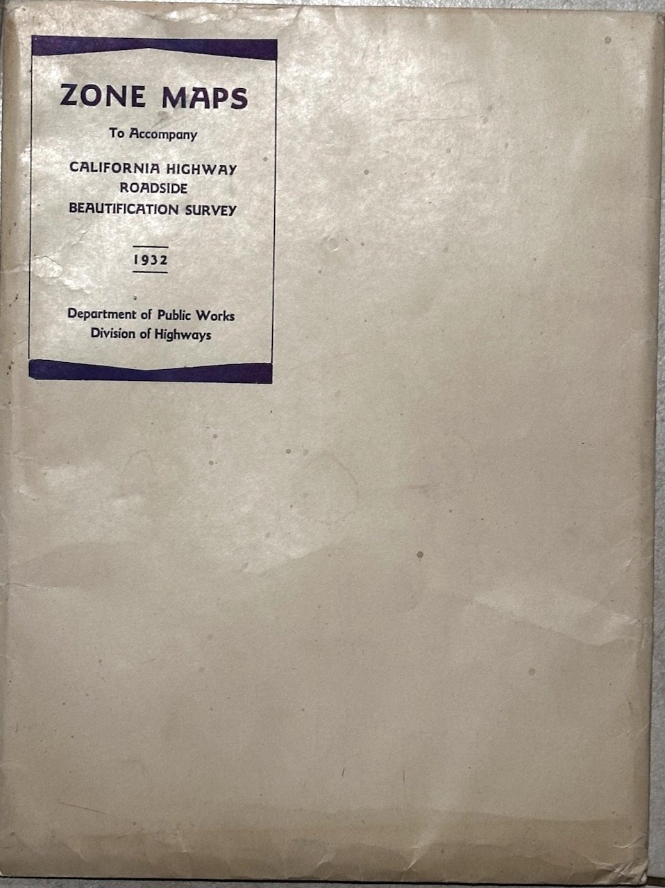
CONDITION: FINE; as-new with sharp folds, no defects. In original manilla envelope with string tie; printed label. The envelope is Very Good.
Scarce: E-copies are online, but none currently in the online market and only 2 of the printed maps in WorldCat, with no complete sets.
Armadillo & Dicker / Books on Main
Scott Burns
5960 S. Land Park. Dr. #408
Sacramento, CA, 95822
United States
Phone: 916.803.2495
Cell: 916.803.2495
Visit Website
Specialities
Golden Age Cinema, Cartoon & Caricature, Ephemera

More Information
Booth 6
Shipping and Returns
Domestic Shipping is via USPS Media Mail, Ground Advantage, First Class Package, or Priority Mail, depending upon the item, the weight, and customer preference. Fedex/UPS/DHL are optional depending upon the destination.Our customary shipping charges:
Media Mail: $4.50
First Class package, when available: $7.50
Priority: $17.50
For items selling for $200 or more, shipping via priority mail is typically included. If an item is unusually heavy or oversized, we may require cost-sharing.
International mail is via USPS First Class Package or Global Priority depending upon the weight.
International first class: $25
International priority: TBD, but typically $65+/-
International buyers, including Canada, should be aware that there may be VAT or customs duties payable upon receipt. Also, some countries are still experiencing post-covid delivery delays; international shipments must either be fully insured or the customer accepting of the risk of loss.
Returns: Satisfaction guaranteed; return within 14 days for full refund.
Open Times
By appointment onlyAdditional Information
Institutions may be invoiced to satisfy any administrative requirements. Reciprocal trade terms are customary.CA sales tax applies to orders shipped within the state, unless a valid CA resale certificate is on file/provided. Visa/MC/Amex, Paypal or will hold 7 business days pending receipt of a personal check/MO.