John Bale Books LLC
Frank Leslie’s War Maps andMAPS / CIVIL WAR Companion to the Newspaper
SOLD
Item Details
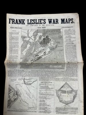
Frank Leslie’s War Maps and Companion to the Newspaper. Second Edition.
New York: Frank Leslie, [1861–1862]. Folio (approx. 16 x 11 inches), 8 pages.
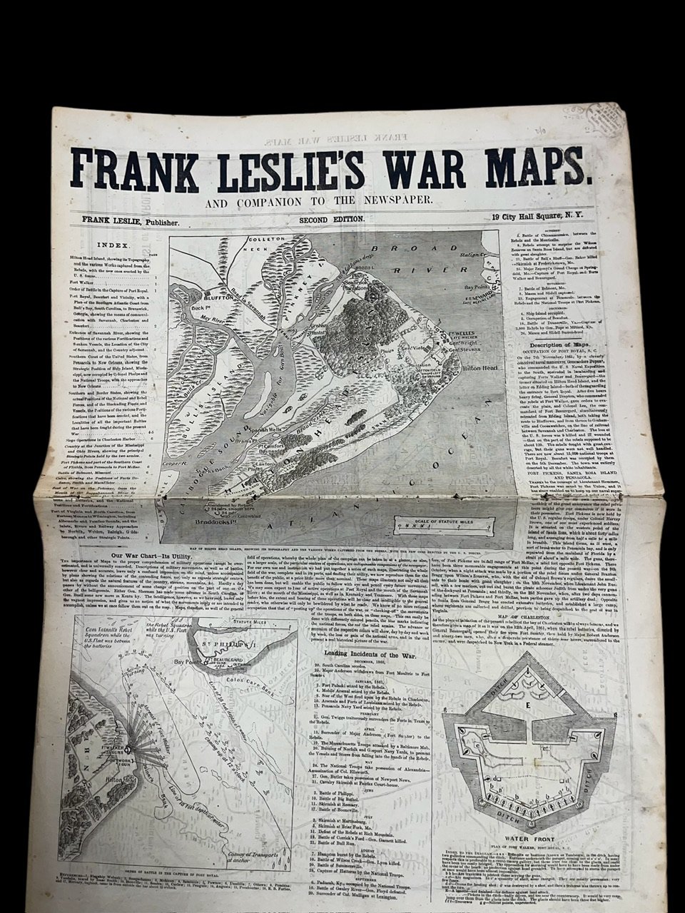
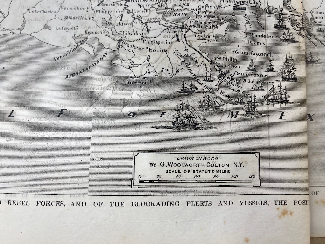
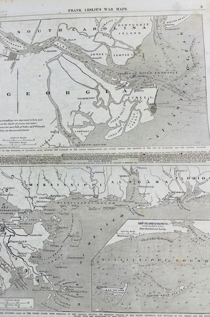
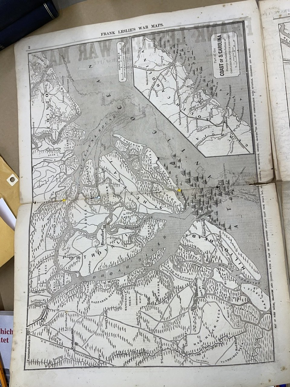
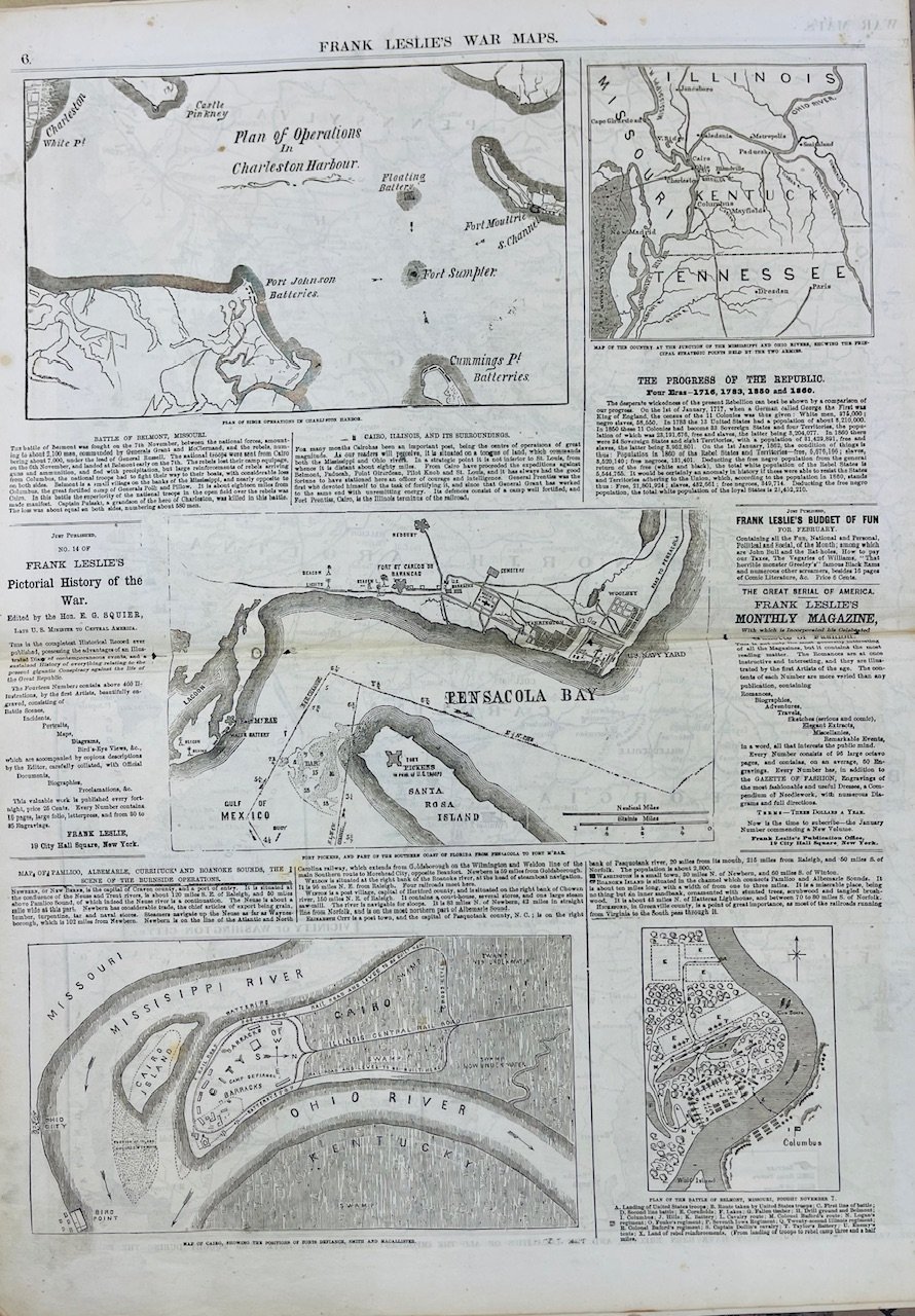
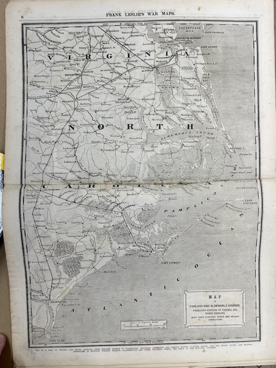
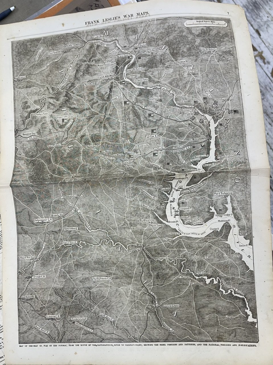
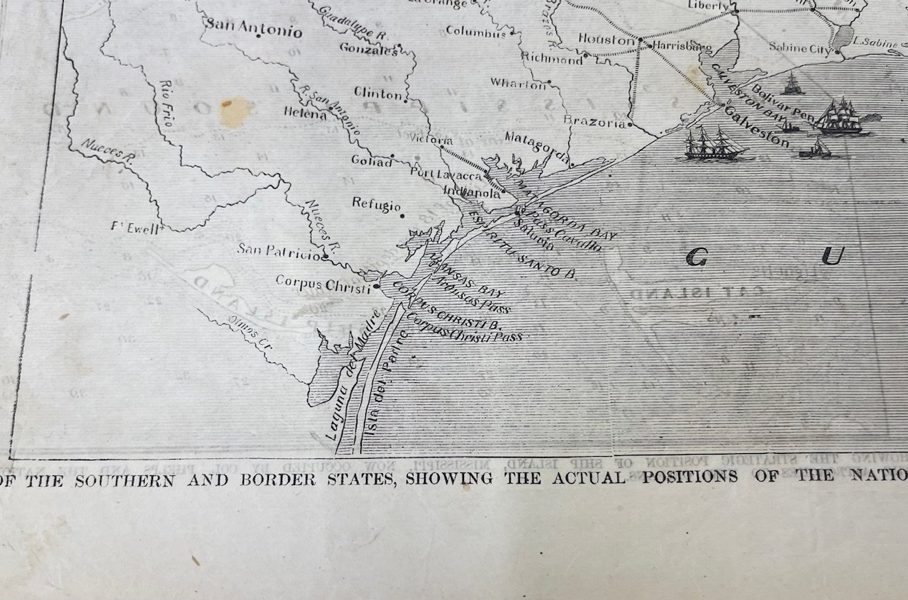
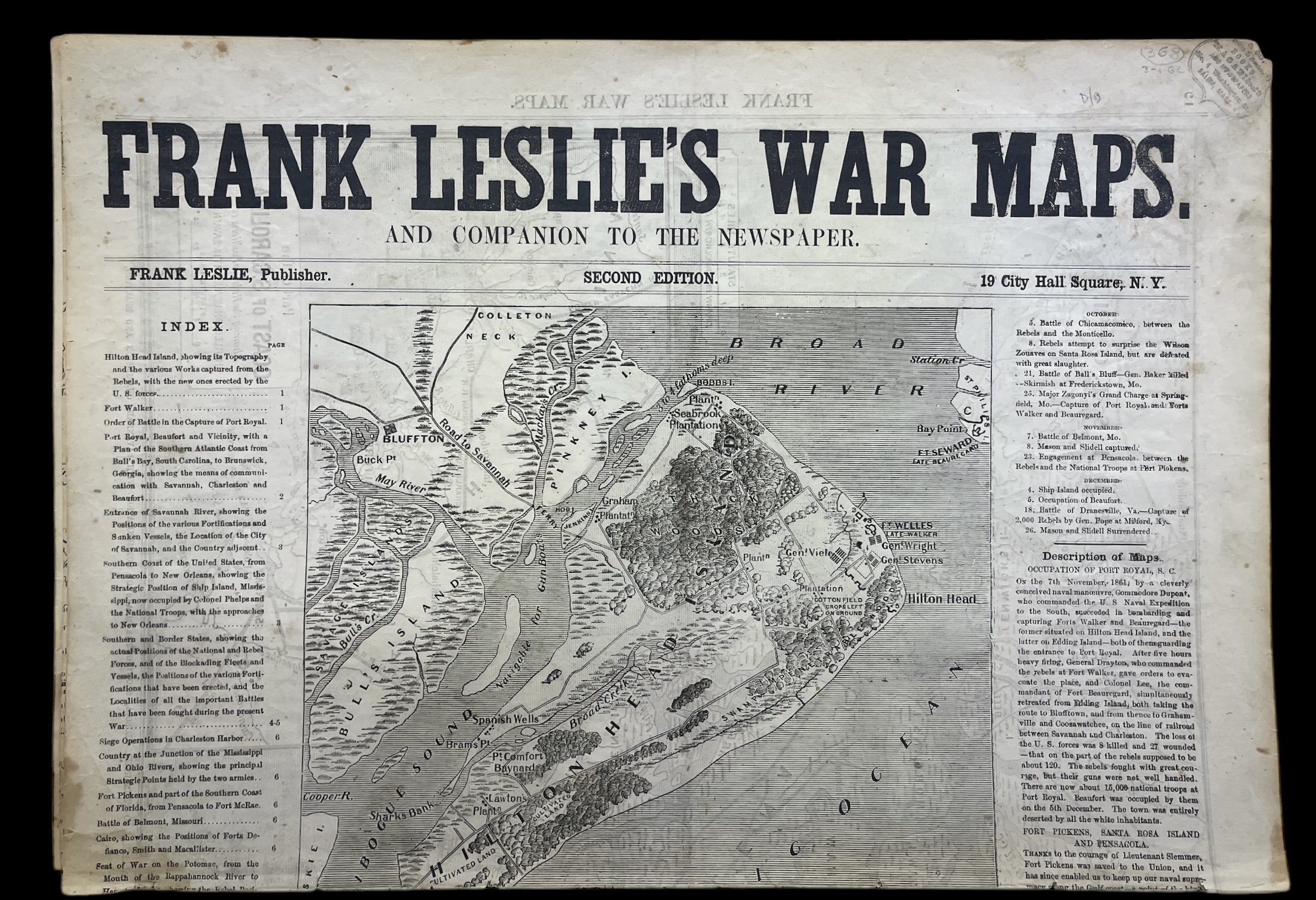
Scarce Civil War cartographic supplement to Frank Leslie’s Illustrated Newspaper, issued early in the conflict. This second edition includes detailed maps of Port Royal, Savannah, Charleston Harbor, Pensacola Bay, Ship Island, the Mississippi Delta, the seat of war in Virginia, and the North Carolina coast. Text descriptions and battle summaries accompany the maps, providing essential context for readers following the war’s progress. Light toning and minor wear at folds; overall well-preserved.A significant early Civil War publication, increasingly uncommon complete.
Civil War, Frank Leslie, Illustrated Newspapers, War Maps, Port Royal, Savannah, Charleston, Ship Island, Virginia Campaign, 1861, 1862, American History, Battle Maps.
John Bale Books LLC
Dan Gaeta
94 West Walk
West Haven, CT, 06516
United States
Phone: 203-232-4338
Cell: 203-232-4338
Featured Catalogue
Visit Website

More Information
Booth 12
Shipping and Returns
Discounts for trade. Text, email, or call to either purchase, hold or inquire about any or multiple items. Domestic shipping $8. Contact us for international or premium shipping options. Be sure to check out our weekly book auction on USIANA.COM
Open Times
Text any time, email if it’s not pressing. 203-232-4338Additional Information
John Bale Book Co. has permanently closed its Waterbury store. Returns and any correspondence should be sent to our mailing address: 94 West Walk, West Haven, CT 06702. Logo artwork by Edith Reynolds, https://www.edithreynolds.com/ Please note—We no longer run an open shop—this is neither a shop address nor a warehouse. Thank you.
Check out our weekly sales through a local auction company— low starting prices, no reserve, with shipping options.