Armadillo & Dicker / Books on Main

AAF [Army Air Force]
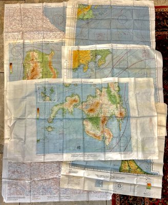
WW2: Cloth Topographic maps of Eastern Asia, Japan, Philippines
$135
Item Details
Army Air Force, 1943
Very Good
AAF [Army Air Force]
WW2: Seven Pilot Escape Maps
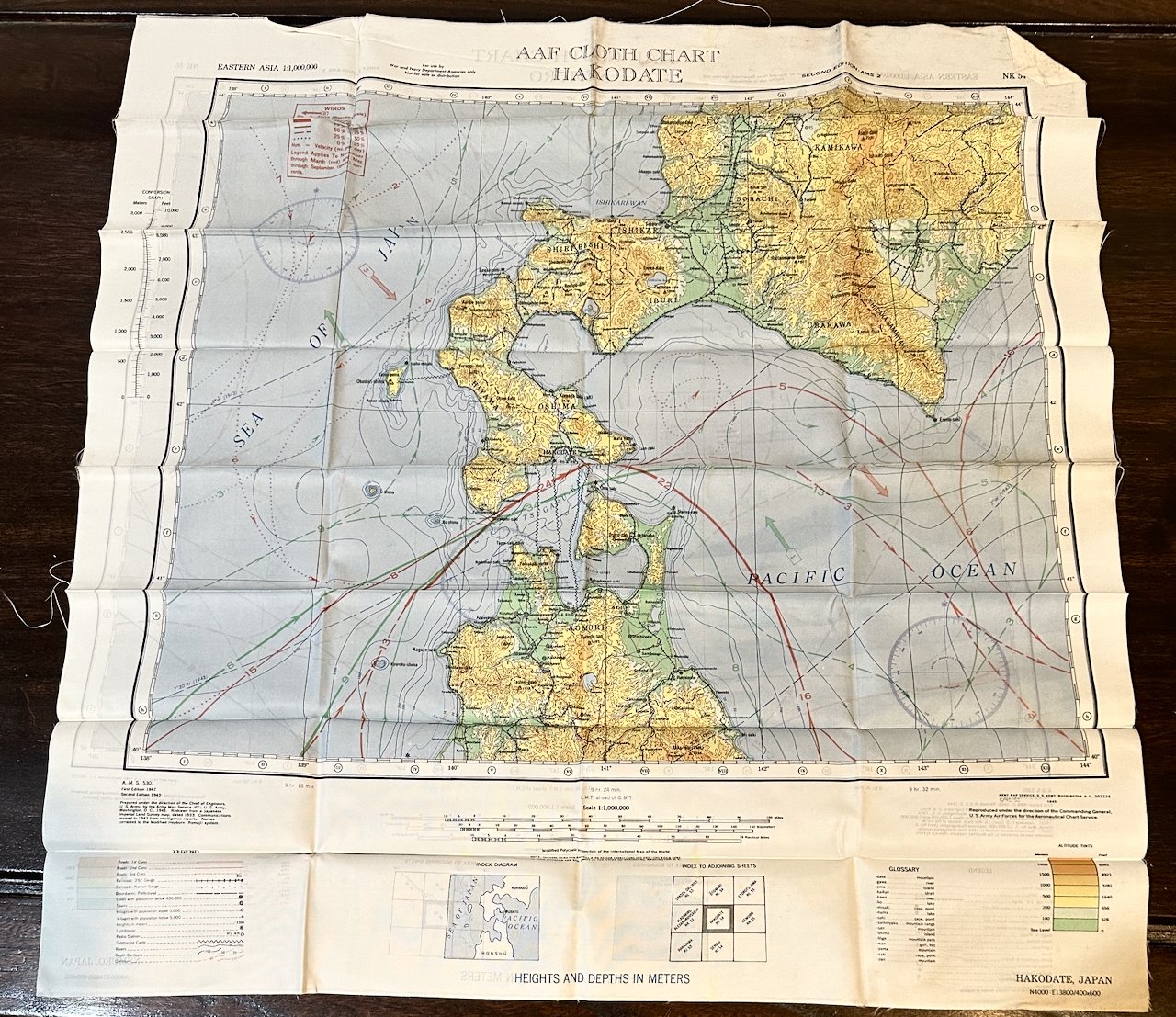
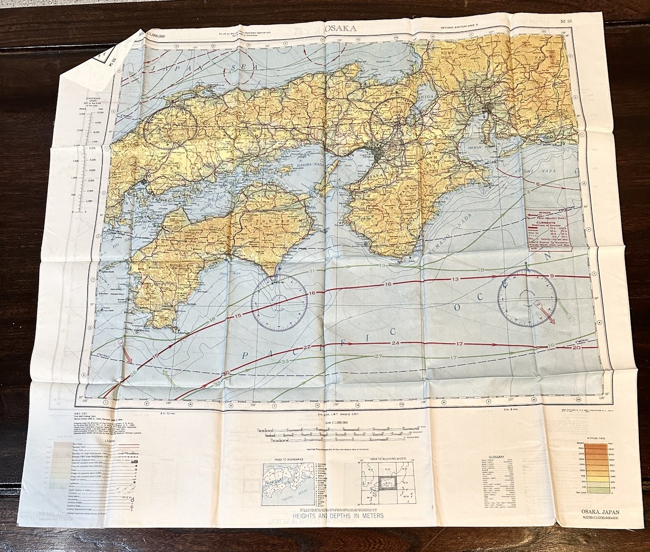
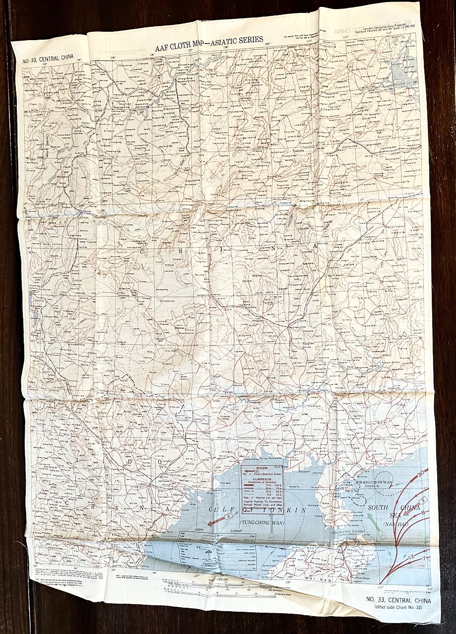
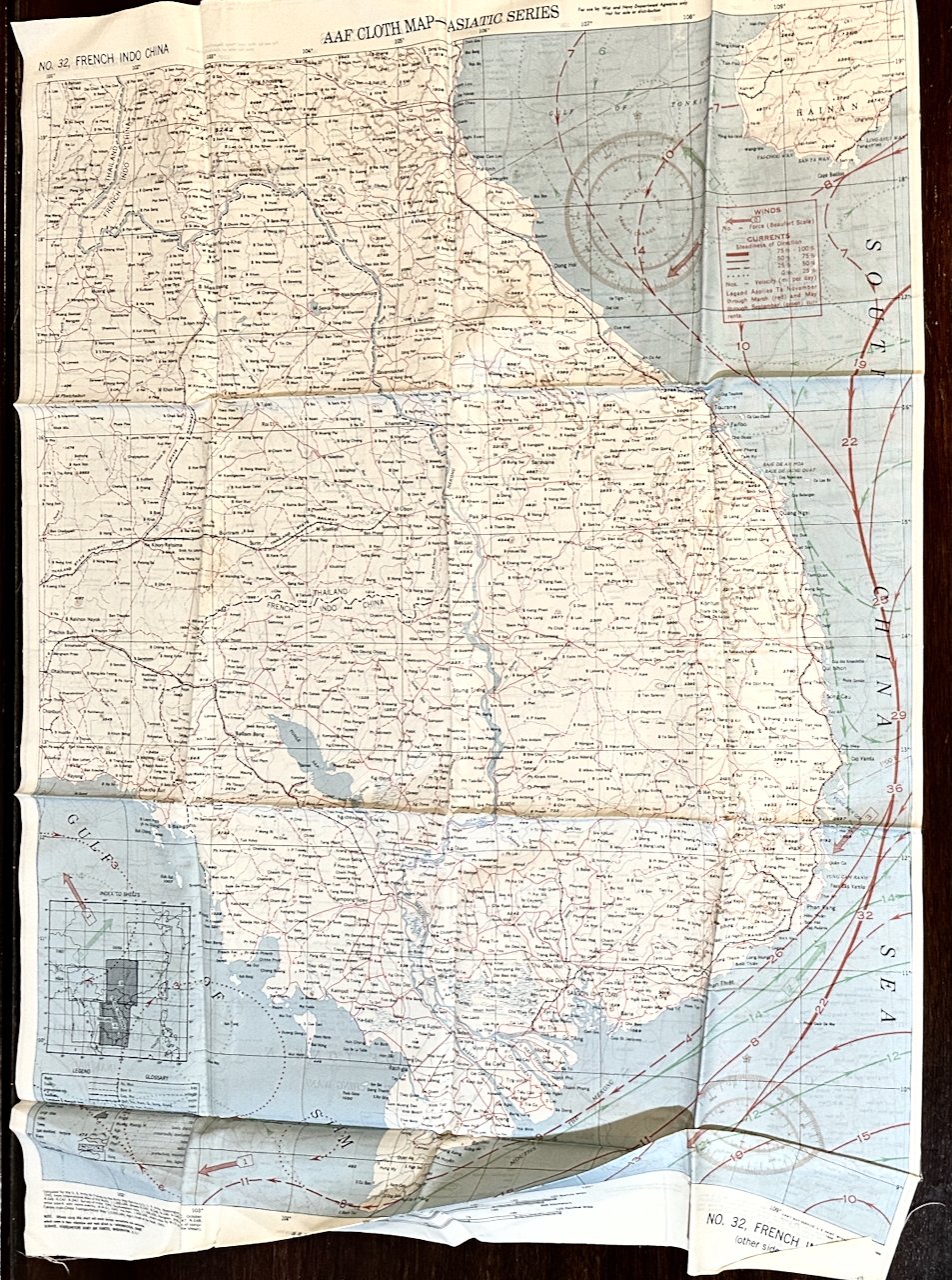
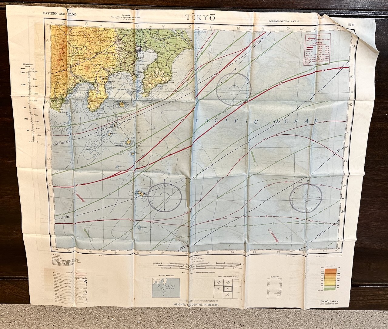
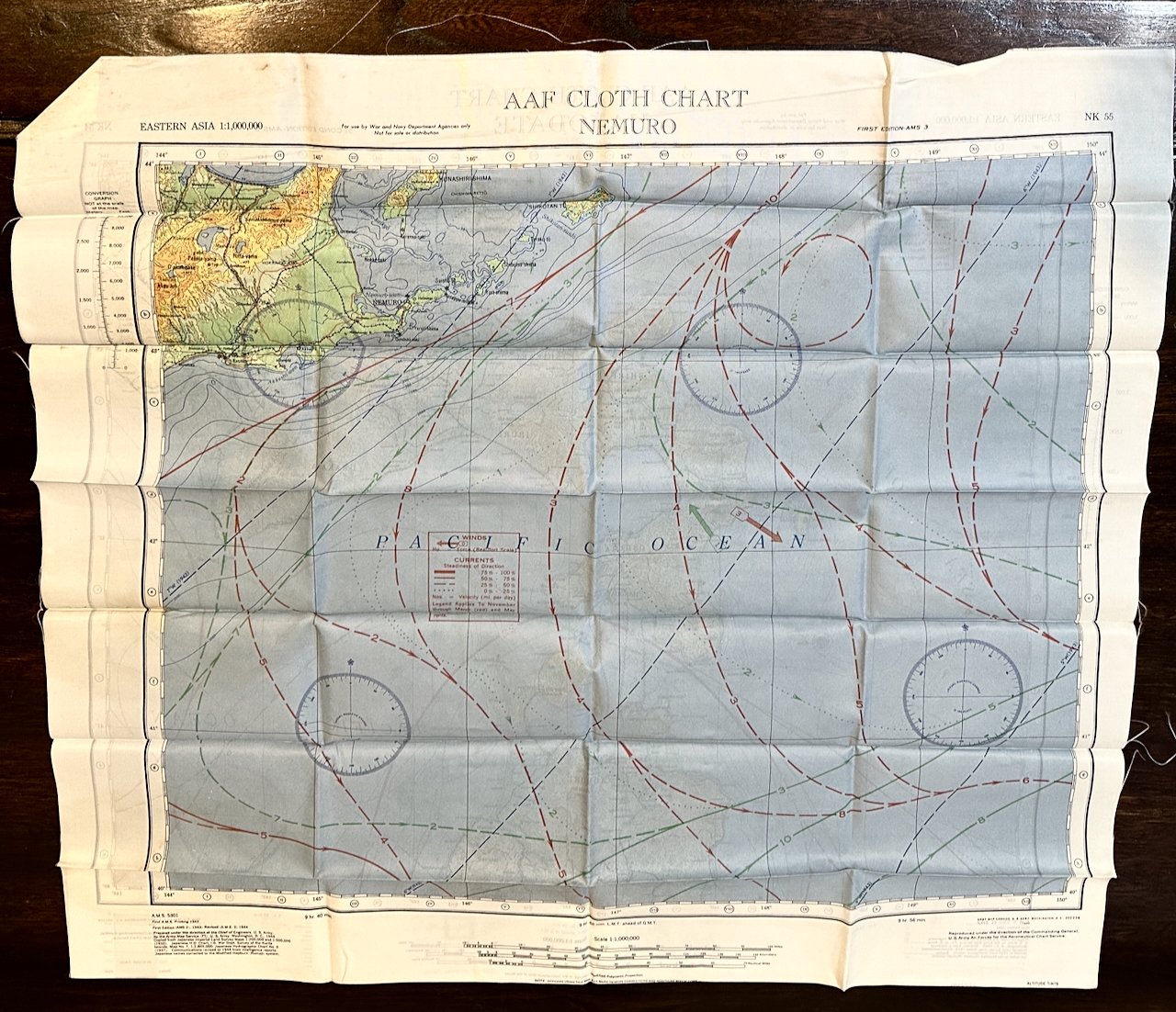
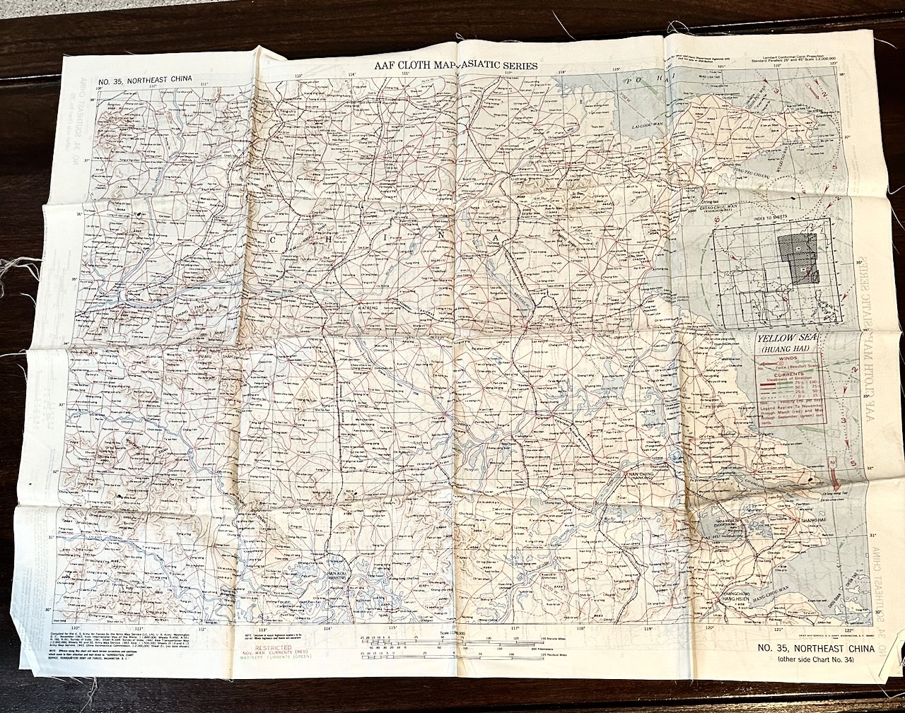
Printed rayon, 1943-44, 2 maps each cloth, printed verso and recto. Various sizes approx. 22”x24” to 20”x45”
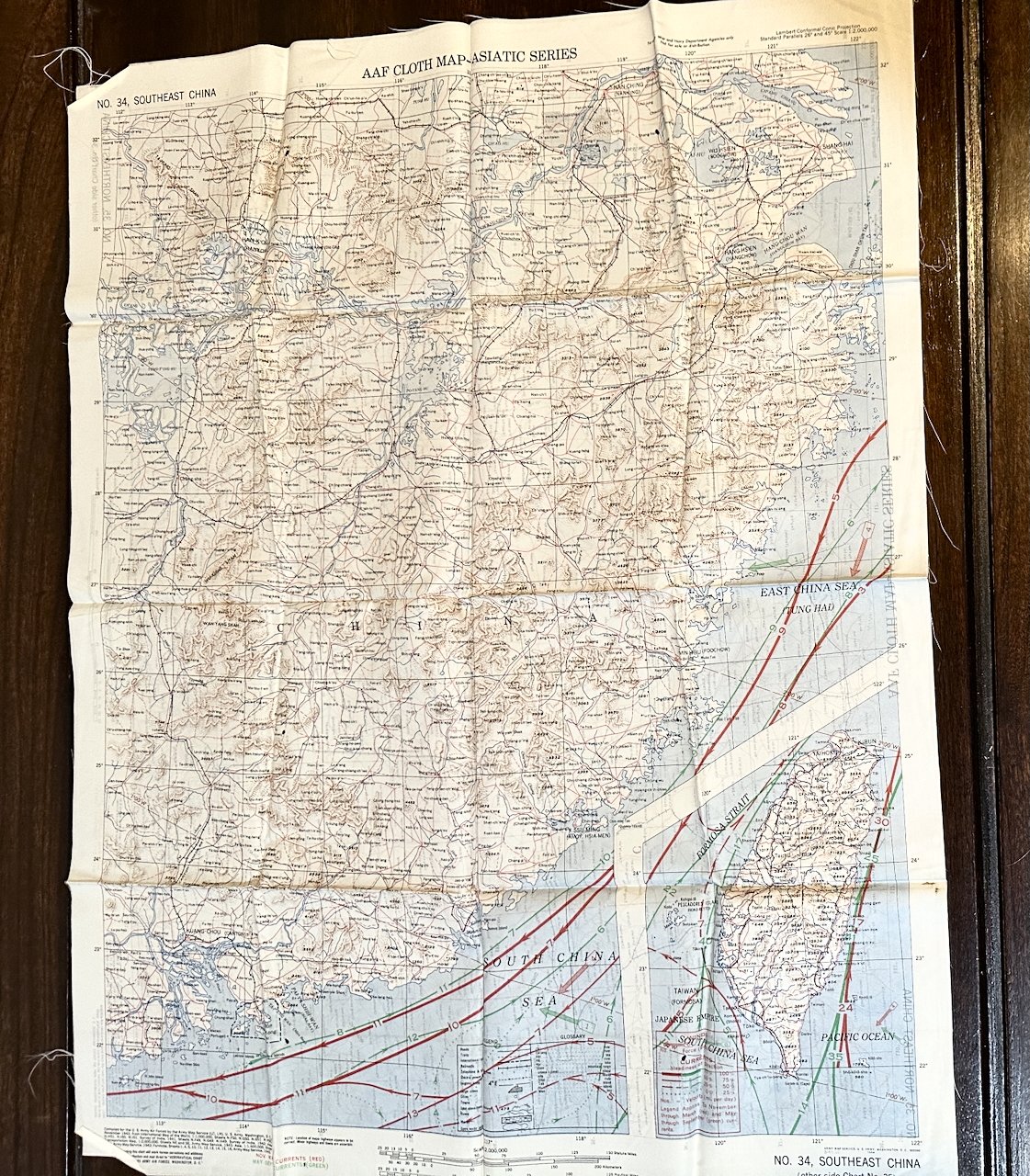
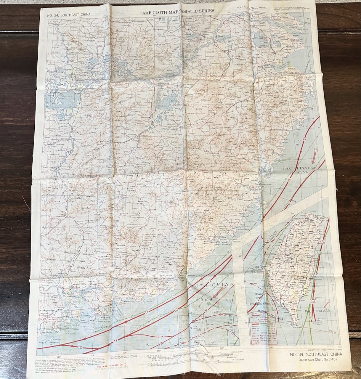
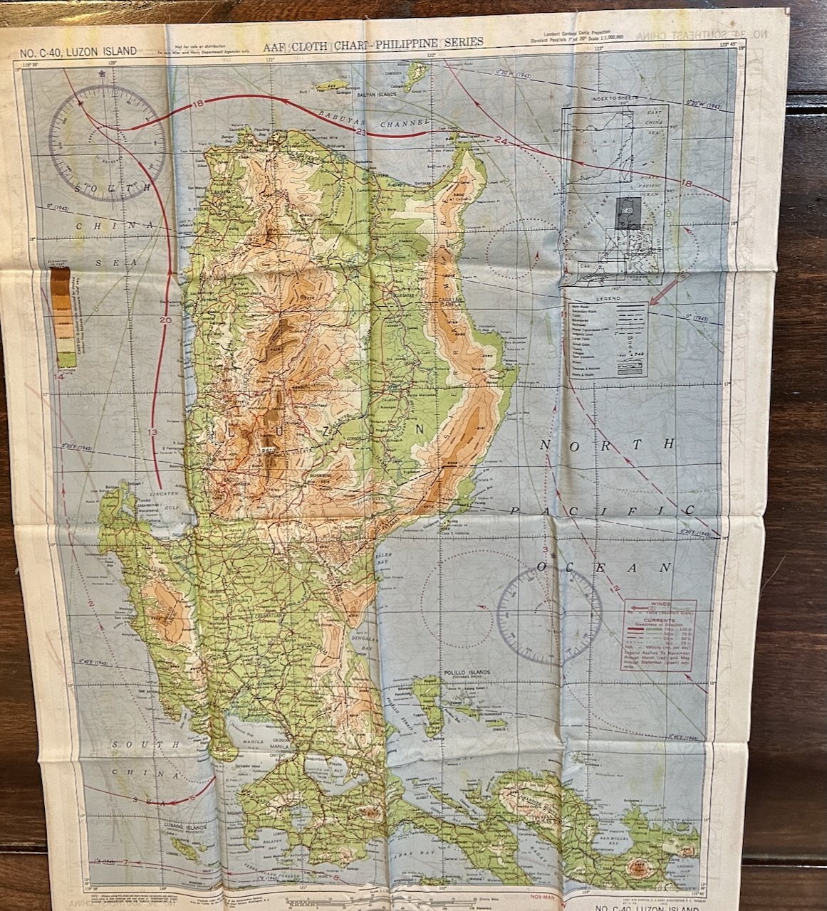
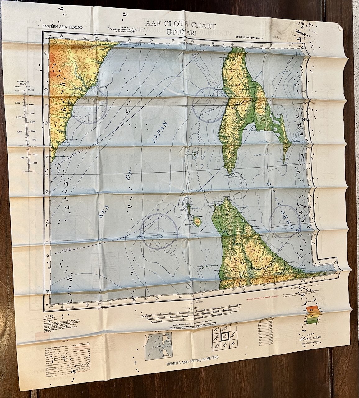
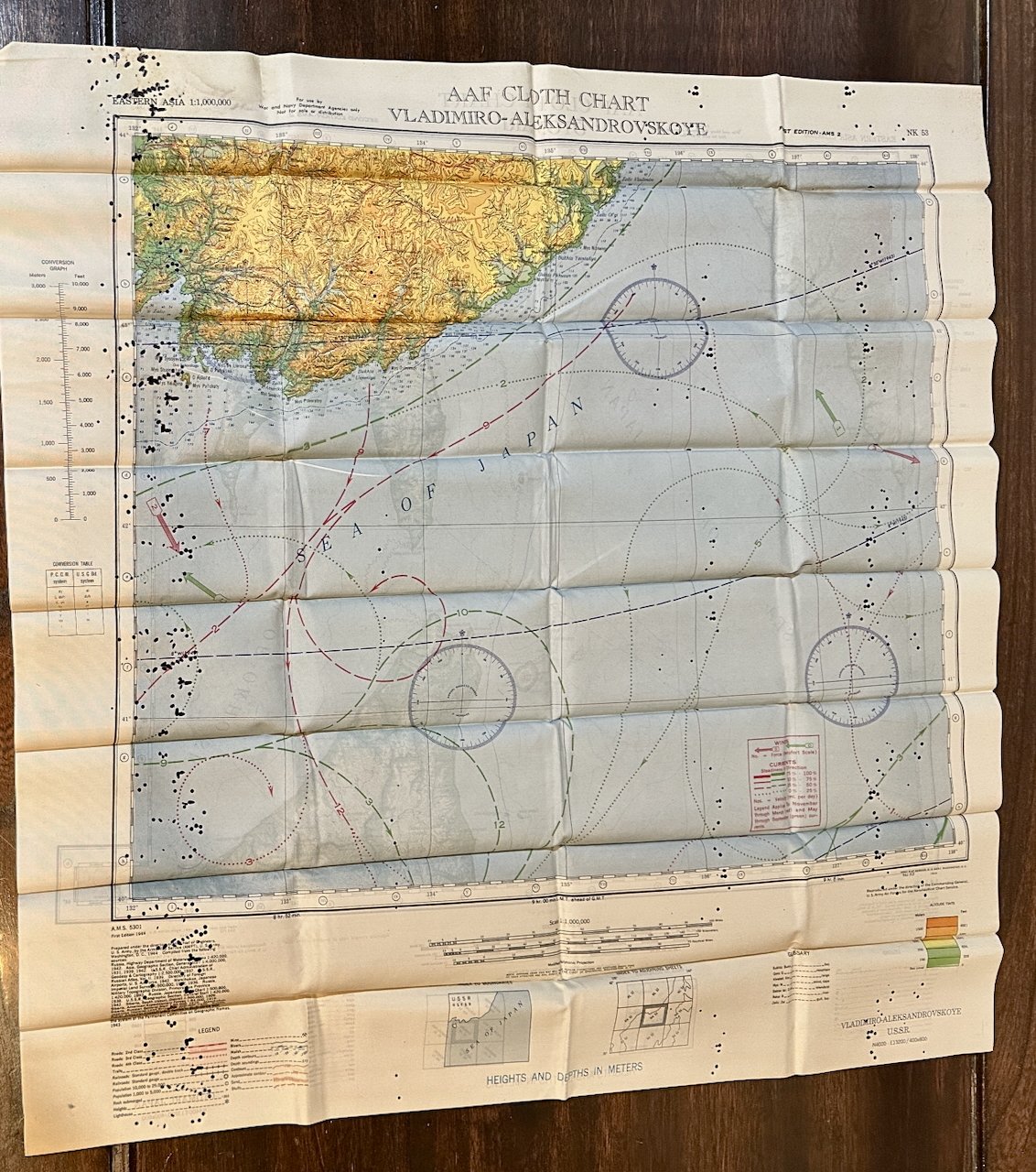
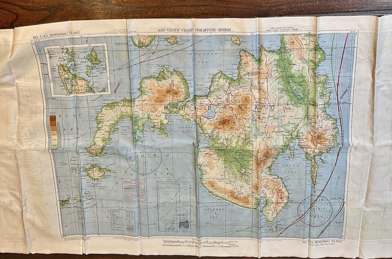
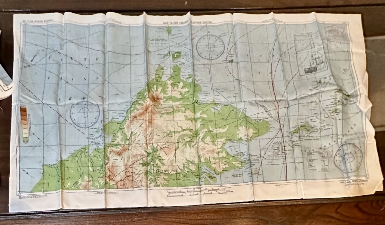
In October, 1942, the U.S. began production of cloth escape maps for pilots forced down on land in enemy held territory. By early 1943, the AAF would require 75 to 100 maps and the Army Map Service commenced mass production which continued until the conclusion of the war. Seven basic colors, corresponding to those used in the conventional paper maps were employed with as many as 17 distinct shades appearing on some maps. Although labeled as “cloth charts”, they were really typographical maps since they were not intended for aeronautical navigation purposes, instead they primarily portrayed topographical features in the land interiors, of major importance for escaping pilots. The seven here:
No. 32 French Indo China / 33 Central China
No. 34 Southeast China / No. C40 Luzon Island
No. 34 Southeast China / No. 35 Northeast China
C-43 North Mindanao / C-44 North Borneo
No. 53 Osaka / 54 Tokyo
Eastern Asia: Otomari/Vladimiro-Aleksandrovskoye
Eastern Asia: Hokodate [Japan] /Nemuro
CONDITION: Overall fine, but folded to pocket size with fold creases that can easily be ironed out. One map [Otomari/Vladimir] has what appear to be insect holes in both right and left quadrants. Another (Mindanao] has four small holes at center. [see photos]
Armadillo & Dicker / Books on Main
Scott Burns
5960 S. Land Park. Dr. #408
Sacramento, CA, 95822
United States
Phone: 916.803.2495
Cell: 916.803.2495
Visit Website
Specialities
Golden Age Cinema, Cartoon & Caricature, Ephemera

More Information
Booth 6
Shipping and Returns
Domestic Shipping is via USPS Media Mail, Ground Advantage, First Class Package, or Priority Mail, depending upon the item, the weight, and customer preference. Fedex/UPS/DHL are optional depending upon the destination.Our customary shipping charges:
Media Mail: $4.50
First Class package, when available: $7.50
Priority: $17.50
For items selling for $200 or more, shipping via priority mail is typically included. If an item is unusually heavy or oversized, we may require cost-sharing.
International mail is via USPS First Class Package or Global Priority depending upon the weight.
International first class: $25
International priority: TBD, but typically $65+/-
International buyers, including Canada, should be aware that there may be VAT or customs duties payable upon receipt. Also, some countries are still experiencing post-covid delivery delays; international shipments must either be fully insured or the customer accepting of the risk of loss.
Returns: Satisfaction guaranteed; return within 14 days for full refund.
Open Times
By appointment onlyAdditional Information
Institutions may be invoiced to satisfy any administrative requirements. Reciprocal trade terms are customary.CA sales tax applies to orders shipped within the state, unless a valid CA resale certificate is on file/provided. Visa/MC/Amex, Paypal or will hold 7 business days pending receipt of a personal check/MO.