Stellar Books & Ephemera
Janvier, Jean
L' Afrique Divisee En Ses Principaux Etats
$280
Item Details
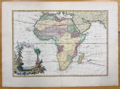
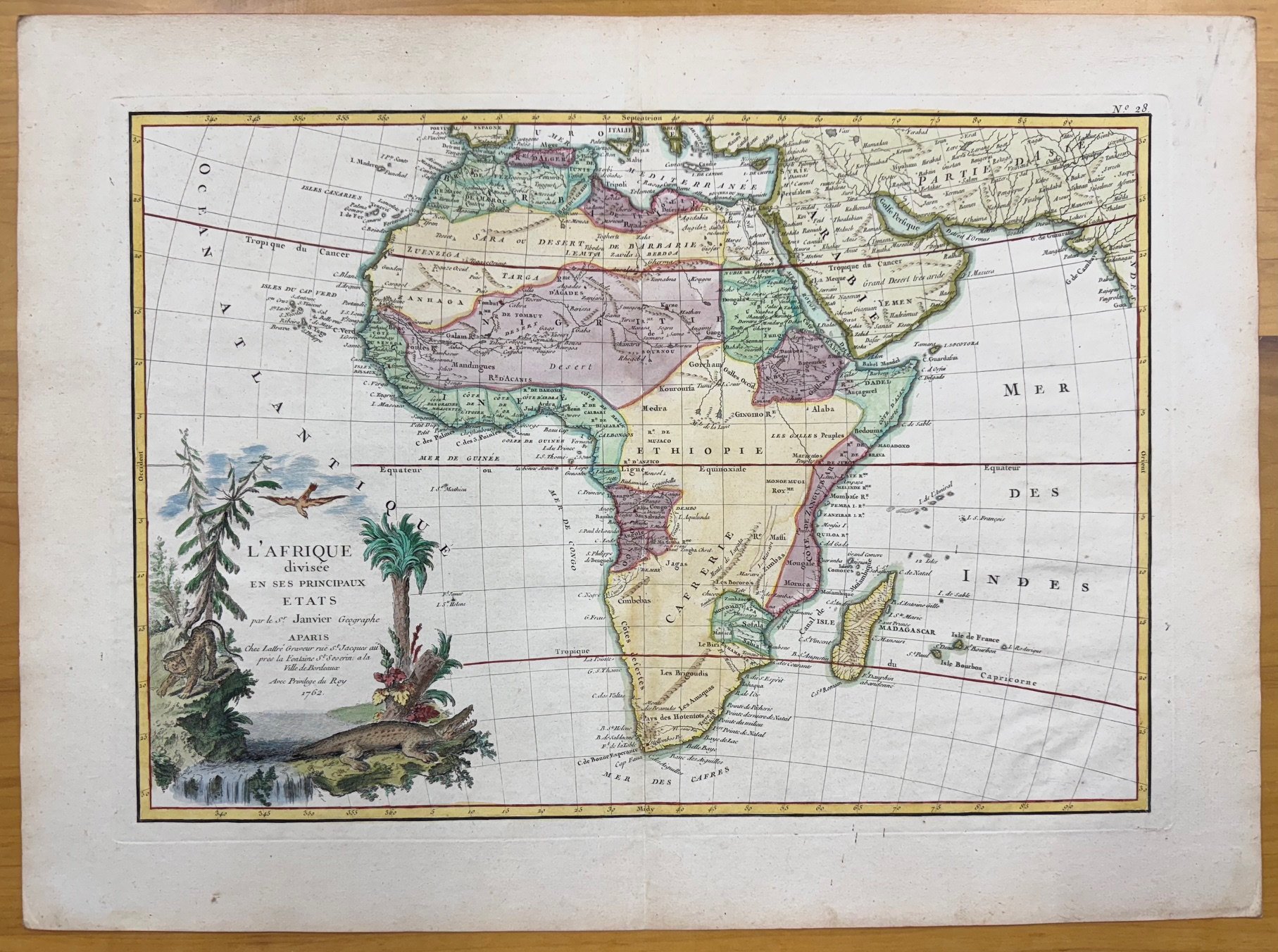
Janvier, Jean. L' Afrique Divisee En Ses Principaux Etats. [Paris]: 1762.
Map of Africa is engraved with hand coloring and decorative cartouche. Large margins, plate measures 17 3/4 x 12 1/2 inches on 15 3/8 x 20 7/8 sheet. Atlas map with corresponding vertical fold. Appears to have had archival repair on verso on hinge. A very good, bright map. Nicely hand colored with a strong plate impression.
Jean Janvier was a Paris based cartographer and geographer active in the mid to late 18th century. Janvier signed his maps, Signor Janvier as this one is.
According to Norwich and Tooley, Janvier collaborated in an Atlas Moderne in 1762 from which this map is number 28 from that atlas. The atlas contained 36 double page hand-colored maps mounted on hinges.
This handsome engraved map, which is fully colored, presents the cartographic knowledge of Africa in the mid 18th century, with a good part of Central Africa blank.
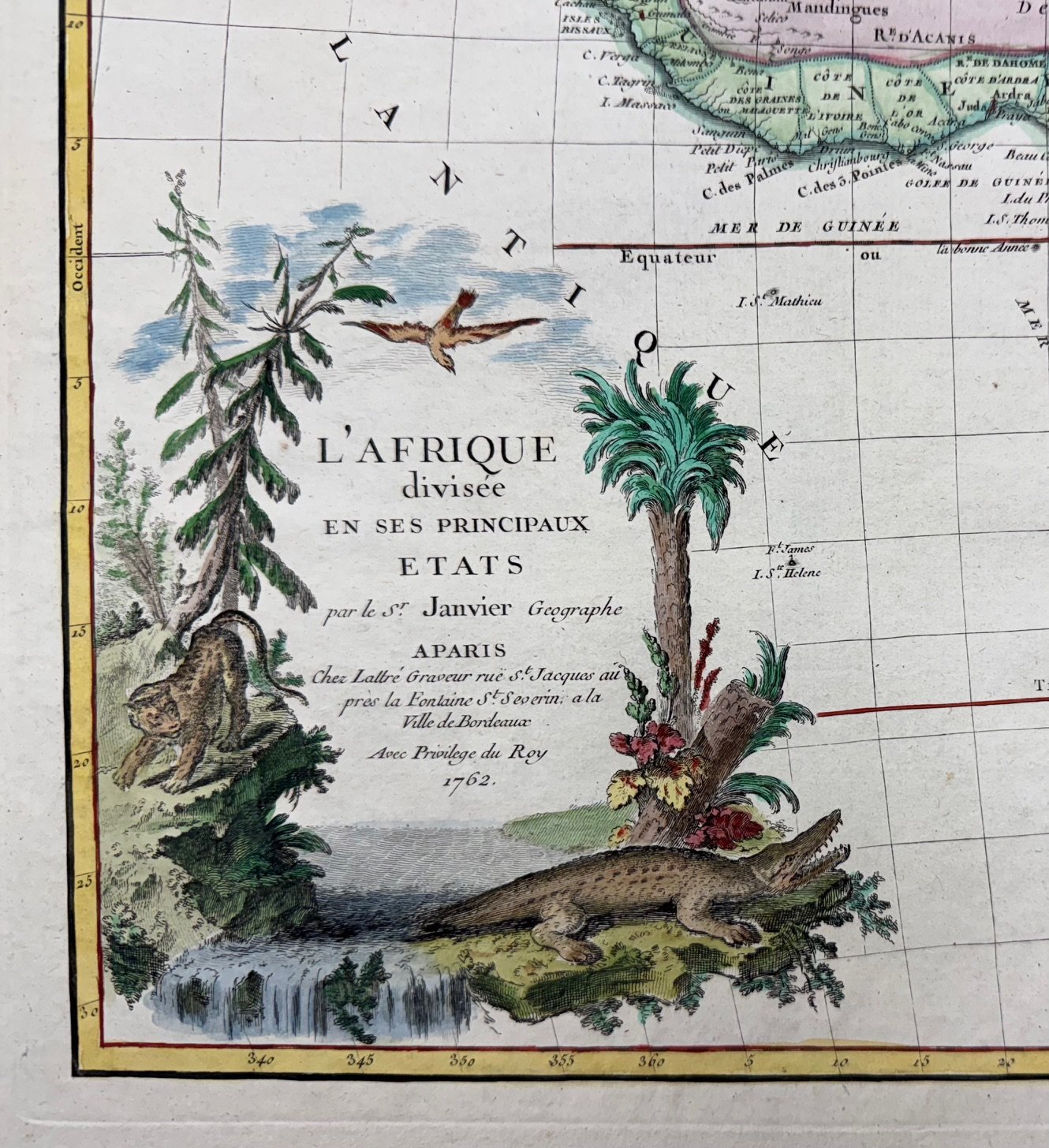
The colorful cartouche, in the lower left corner of the map, portrays several trees, a large bird, a stalking leopard, and a snarling crocodile.
Stellar Books & Ephemera
Andy Nettell
20 Business Park Loop #864
Carlsborg, WA, 98324
United States
Phone: 435-260-8596
Cell: 435-260-8596
Visit Website
Specialities
Ephemera, Manuscripts, Letters, OOAK
.jpg)
More Information
Booth 19
Shipping and Returns
All items guaranteed and returnable within 30 days for any reason. Reciprocal dealer discounts offered plus extended dating for institutions. We accept checks, credit cards, PayPal and Zelle.
Open Times
10 am to 10 pmAdditional Information
We buy collections or single items. Always looking for quality Americana.